Potatoes, the adaptable and beloved vegetable, are used in a wide variety of delectable cuisines around the world. Yet even the most experienced home cooks may find it difficult to achieve the ideal texture and doneness for everything from creamy mashed potatoes to crispy roasted treats.
But fret not. We’ve put together a thorough guide with crucial advice to make sure your potatoes always come out tender, tasty, and cooked evenly. These tried-and-true methods will take your potato recipes to a whole new level of taste, whether you’re a potato fanatic or a culinary newbie.
Choose the Right Potatoes
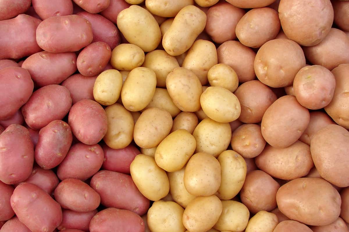
Source: healthyfamilyproject.com
Choosing the proper type of potatoes for your dish is the first step in perfectly cooking the vegetable, as the textures and flavors of different potato varieties affect how they cook and taste. Two main types of potatoes are commonly used in recipes: starchy and waxy varieties.
Waxy potatoes, such as red or new potatoes, have more moisture and less starch. They maintain their shape while cooking and can be boiled, roasted, grilled, or added to salads. They are perfect for dishes where potatoes need to maintain shape because they have a creamy feel without turning mushy.
On the other hand, starchy potatoes, like Russets, Yukon Golds, or Idaho potatoes, have a high starch content and little moisture, which makes them ideal for recipes that involve baking, such as baked potato soup, gratins, and mashed potatoes. They cook quickly and easily, creating a creamy, fluffy texture that readily absorbs flavors.
Cut Potatoes Uniformly
A crucial step in creating well-cooked and delicious recipes is ensuring your potato pieces are of a constant size and thickness. Uniformity in potato cuts guarantees that all the pieces are cooked at the same temperature and for the same amount of time, whether you’re boiling, roasting, or frying them. This prevents uneven cooking results.
Potatoes should be diced into roughly equal-sized pieces, ideally in the range of 1/2 to 3/4 inch cubes. Use a mandoline or a sharp knife to slice the food into slices that are all the same thickness. To ensure consistent roasting or frying, keep the wedges’ sizes as similar as possible when cutting them.
The presentation also benefits greatly from uniform size and thickness. The dish looks attractive when the potato chunks are the same size. Moreover, evenly cooked potatoes help the finished dish’s texture and flavor to blend harmoniously.
Parboil Before Roasting or Frying
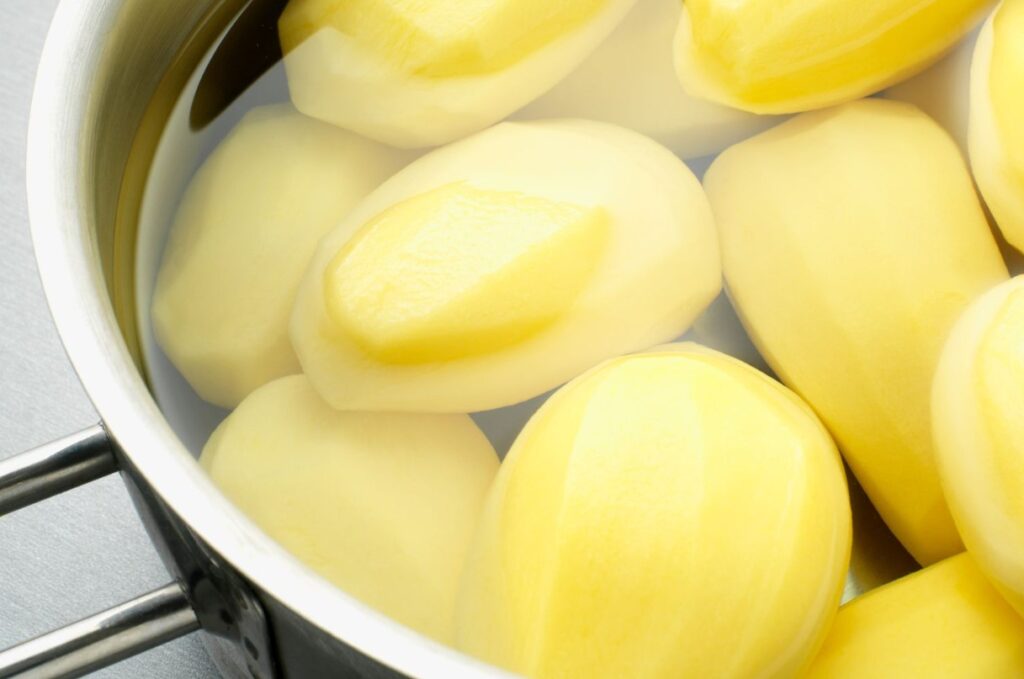
Source: thespruceeats.com
A useful method for guaranteeing precisely cooked roasted or fried potatoes is parboiling, as you can jump-start the cooking process and cut down on the total amount of time needed to cook the potatoes to the desired doneness. Doing this is helpful to ensure that the centers of larger or denser potato pieces cook properly without burning the outside.
As previously said, chop the potatoes into uniform pieces before parboiling them. Then, add the potato chunks to a pot of boiling, salted water. When punctured with a fork, cook them for a few minutes, usually 5-7 minutes, or until they start to soften. Take care not to overcook them at this point because they will continue to cook while being roasted or fried.
You can guarantee that your potatoes cook uniformly and have the ideal texture and flavor balance for your delicious potato creations by adding the parboiling phase to your roasting or frying process.
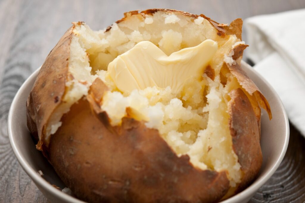
Use the Right Cooking Technique
You can maximize the versatility of potatoes by being aware of the specific needs of each potato recipe and selecting the proper cooking technique. The chosen method greatly impacts the final product’s texture, flavor, and aesthetic appeal.
While roasting results in a crispy outside and a fluffy interior, boiling yields soft and supple potatoes, perfect for mashed potatoes. Proper cooking methods improve flavor since boiling makes it easier for potatoes to absorb seasonings, roasting brings forth sweetness, and gradual baking harmonizes flavors in gratins. Throw some salted butter on your potatoes, and they’ll be perfect!
Useful techniques also minimize the possibility of undercooking or overcooking, assuring even and ideal doneness.
This also has an impact on the dish’s aesthetic appeal. The appropriate approach increases the presentation, whetting the appetite, whether it’s creamy gratin or crunchy roasted potatoes. Additionally, the right technique minimizes nutrient loss and maintains the intrinsic benefits of potatoes, preserving their nutritious content.
Do Not Overcook
Source: tastingtable.com
A common error that can result in unfavorable results, such as a mushy texture and bland flavor, is overcooking potatoes. It’s crucial to carefully watch the cooking time and frequently check the potatoes’ doneness to prevent this.
Start checking for doneness in potatoes that are being boiled or steam-cooked a few minutes before the recipe’s suggested cooking time. Simply stick a fork or knife into the potato for the fork test. The potatoes are ready to be taken off the fire when the fork slides in with no resistance and the potatoes are fork-tender.
Repeat the test after a few more minutes of cooking if the potatoes are still hard and showing resistance.
Also, watch your potatoes carefully while roasting or baking them by using the same fork test. The potatoes are ready to be removed from the oven if they are tender and readily punctured. Err on the side of caution to maintain the ideal texture and flavor because residual cooking can still happen even after the heat is turned off.
Rest Before Serving
The quality of potato meals is substantially enhanced by letting cooked potatoes rest for a short while before serving. The potatoes’ uniform moisture distribution during this resting time results in a smoother and more consistent texture. This is especially crucial when making mashed potatoes.
The dish’s flavors might also blend during the resting period, giving it a more appetizing and harmonious flavor. The starches in the potatoes firm as they cool, improving the texture and averting a crumbly consistency.
Furthermore, the temperature of the meal is also balanced while it rests, making it more comfortable and enjoyable to eat. The cooked potatoes can be kept warm and kept from drying out by being covered during this time.
Conclusion
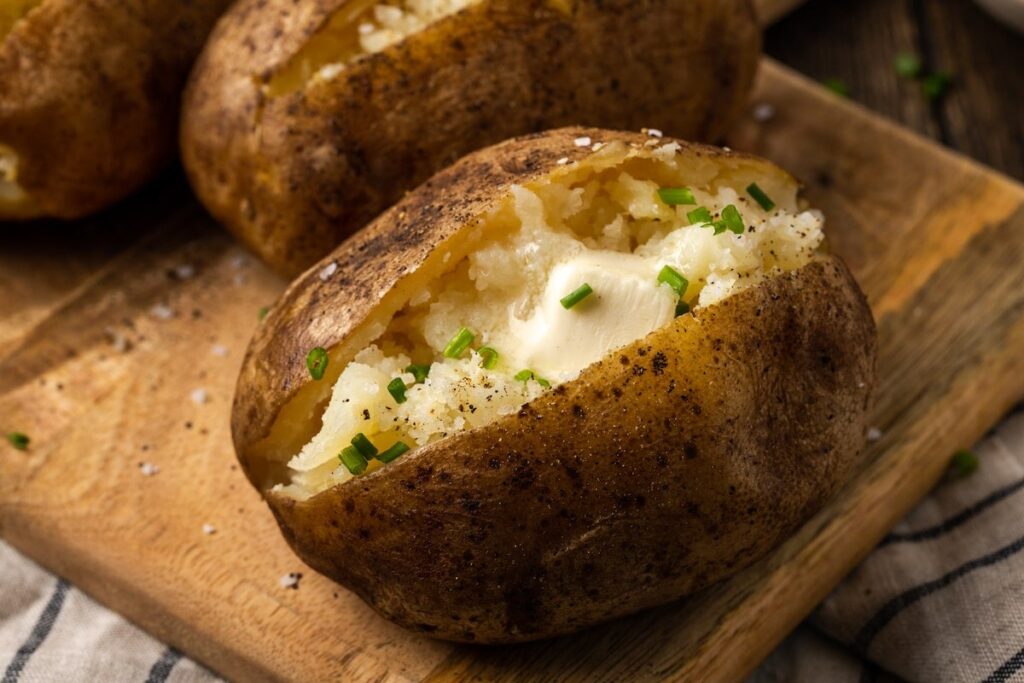
Source: cookiesandcups.com
It takes careful attention to detail and a few key pointers to cook potatoes to perfection. Your potato recipes will always be tasty and filling if you choose the right potatoes, cut them uniformly, use the right cooking methods, and refrain from overcooking. You’ll be well on your way to perfecting the art of perfectly cooking potatoes if you keep these suggestions in mind.